


Floodplain Determinations
The Floodplain Manager can locate your property and give you an accurate assessment of risk of flood for lending, insurance, retrofitting, or preparedness purposes. To request an official determination for your property within the City of Charleston, send an e-mail to our Floodplain Manager containing the following information:
Contact name, phone number, physical mailing address, and e-mail address
Address of the property for which the determination is being requested
Preferred method of communication
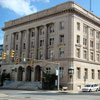
Or call or visit our office:
Floodplain Manager
Chuck Grishaber, CFM
915 Quarrier Street, Suite 1
Charleston, WV 25301
P: (304) 348-8105
F: (304) 348-8042
Additionally, prior to the issuance of any building permit, the Floodplain Manager will determine if your property is located in the flood zone. If the Floodplain Manager determines that the property is inside or close to the flood zone, it may be recommend that an Elevation Certificate is obtained.
An Elevation Certificate is completed by a licensed surveyor or registered professional engineer who accurately measures the height of your structure in relation to the height of the flood zone. The certificate will help determine the proper insurance premium rate, help with application for a building permit, or support a request for a Letter of Map Amendment (LOMA) or Letter of Map Revision based on fill (LOMR-F). This is a low cost way of accurately assessing your risk that often pays for its self in a short period of time.